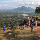

From trekking to Adam's Peak to hiking through Sinharaja Forest Reserve, Sri Lanka has many superb trails © Dudarev Mikhail / Shutterstock
For many visitors, Sri Lanka is all about blissful, blonde beaches, but another world – perfect for hikers – awaits in the rugged, mountainous interior.
It was only when railways were built through the highlands that vehicles replaced hiking as the main way of getting around this stunning tropical island. Modern-day trekkers can enter a wonderland of ruins, sacred sites, epic viewpoints and tumbling tea estates, within easy striking distance of the coast.
With Sri Lanka's manageable scale – the island measures just 431km long by 224km wide (268 miles by 139 miles) – there are few complicated logistics for hikers to worry about. You’ll need a guide for walks in national parks (and off-the-beaten-track treks elsewhere) but most trips are easy day hikes, so you can turn up and start walking, safe in the knowledge that there'll be a filling plate of rice and curry waiting at your guesthouse at the end of a satisfying day on the trail.
Here's our selection of Sri Lanka's best hikes.
YouTube video player
Adam's Peak
Best spiritual hike
7km (4 miles), 2.5–4 hours, moderate
Known variously as Adam’s Peak (the spot where Adam first set foot on earth after being cast out of heaven), Sri Pada (the "sacred footprint" left by the Buddha as he headed towards paradise) and Samanalakande (Butterfly Mountain, where butterflies go to die), Sri Lanka’s most sacred summit is revered by Buddhists, Hindus, Muslims and Christians alike. The dawn hike up the 5200 steps leading from the village of Dalhousie to the mountaintop is as much a spiritual journey as a physical expedition, offering a window onto Sri Lanka’s soul as well as views over its jaw-dropping landscapes.
Most undertake the strenuous hike during the pilgrimage season, which begins on the poya (full moon) day in December and runs until the Vesak festival in May. Pilgrims start walking at 2am to reach the summit before dawn, but you can begin the climb from Dalhousie soon after night falls to beat the crowds, who slow progress to a snail’s pace on poya days. At the summit, catch your breath as you watch the dawn sun illuminate Sri Lanka like a blessing, then pay your respects at the rock footprint left by the Buddha, Shiva or Adam (depending on which legend you subscribe to).

Little Adam’s Peak and Ella Rock
Best easy hike
4.5km to 10km (3 to 6 miles), half-day, easy
Ella is the hiking hub of the hills, and pretty much every guest house in town can provide a map of the tracks and trails that wind between the ridges to tea estates, waterfalls and viewpoints. It’s easy to fill several days wandering to lookouts and posing for pics (or watching Instagrammers do the posing) beside the landmark Nine Arches Bridge. Staying in a guesthouse also means a fabulous, home-cooked meal at the end of a day of walking.
Start your explorations with the 4.5km (3 mile) round-trip to Little Adam’s Peak – a green knoll with great views of waterfalls and tea factories shimmering out of the mist that cloaks the surrounding hills. The 10km (6 mile) walk to Ella Rock is more demanding, but also more rewarding; a sustained climb through classic highland country, starting right on the railway tracks at Ella Station. A final ascent through eucalyptus forests will drop you on top of a rocky outcrop with dizzying views over the hill country (and mobs of resident monkeys waiting to relieve you of any snacks you brought along for the journey).

Sinharaja Forest Reserve
Best hike for bird lovers
Distances vary, 2–3 hours, easy
The largest lowland rainforest in the country, Sinharaja Forest Reserve is a biodiverse wonderland, framed by rivers and buzzing with forest wildlife, including rare mammals and 147 bird species, 33 species of which are only found in Sri Lanka. Entry to Sinharaja is on foot (not by 4WD), with a mandatory guide to keep you safe in the dense and damp undergrowth.
Most hikers base themselves in the villages of Deniyaya or Kudawa, where you can purchase entry tickets and arrange a trek with the guides hanging around the park gates. Plan to stay nearby in order to access the park early in the morning when the trails are quiet and the wildlife is most active, before the tour groups arrive from the coast. The Sinharaja Rain Forest View Villas at Deniyaya is a lovely jungle escape that won’t burn too big a hole in your holiday budget.

Sigiriya and Pidurangula
Best hike through history
1–3km (0.6–1.9 miles), half-day to one day, moderate
Okay, it’s not a trek in the classic sense, but there’s plenty of tramping required to gain the summit of Sri Lanka’s most famous lookout, crowned by the ruins of King Kasyapa’s palace. To reach the evocative sprawl of ruins on top of this imposing granite outcrop, you'll need to climb nearly 1200 steps. The reward for all this exertion is a view over an endless sweep of Sri Lankan countryside extending to the horizon in all directions – just watch out for the bothersome wasps on the way up!
For views with more privacy, walk for about a kilometer (0.6 miles) to reach the 5th-century monastic complex at Pidurangula, crowning another rocky outcrop to the north of Sigiriya. It’s a half-hour clamber past ancient Buddhist temples and carvings to the summit, which looks out over a carpet of forest with the mighty mass of Sigiriya rising like a stone exclamation mark in the middle of the vista. Come with your own transport and you can add on a slender loris-spotting night walk with the resident naturalist at the Jetwing Vil Uyana hotel near Kimbissa.

Horton Plains & World’s End
Best hike for views
9.5km (6 miles), three hours, easy
World’s End is the apt nickname for the sheer drop-off at the edge of the Horton Plains, which looks out over one of Sri Lanka's most jaw-dropping vistas. When we say "plains," we actually mean an undulating plateau over 2000m (6560ft) high, covered by wild grasslands, rocky outcrops, filigree waterfalls, misty lakes, and patches of thick forest teeming with birdlife.
Horton Plains National Park is one of the few reserves where visitors can walk unaccompanied, but there’s no public transport, so you’ll need to arrange a drop-off and pick-up in Nuwara Eliya or Ohiya. After a 4km (2.5 mile) hike across the plateau, the terrain drops away without warning at World’s End. The views of the lowlands floating below are awesome when the weather is clear, but come early in the morning to beat the crowds and the clouds. The trail loops back to pretty Baker’s Falls before returning to the national park entrance at Far Inn, so you’ll need about three hours to complete the 9.5km (6 mile) round trip.

Lipton’s Seat
Best hike for tea enthusiasts
8km (5 miles), 2 hours, easy
For a taste – or should that be a sip? – of Sri Lanka's tea country, head to the town of Haputale, floating in a sea of tea gardens in the middle of the island. The tea estate at Dambatenne was founded in 1890 by Thomas Lipton, whose name still appears on teabags served at breakfast all over the globe, and the lookout is known as Lipton’s Seat, where he came to survey the plantations. The viewpoint makes a fine day walk from Haputale, and you can combine the trip with a tour of the still-working Dambatenne Tea Factory to see the tea-making process.
From the factory, tangled footpaths climb for about 8km (5 miles) to reach the lookout, winding through tea plantations crowded with "tea pluckers" filling their bags with the raw ingredient for tomorrow’s cuppas. In practice, most visitors do the trip in reverse, taking a bus or tuk-tuk to Lipton’s Seat to arrive early in the morning when the views are clearest, and then strolling downhill through the tea gardens to reach the factory.

The Knuckles
Best hike for adventurers
Distances vary, 1–2 days, hard
To trek off the tourist map in Sri Lanka, head to the densely forested Knuckles Range northeast of Kandy. This rugged massif forms part of the Unesco-listed Peak Wilderness Protected Area, founded to protect the island’s threatened montane and cloud forests. Hiking in the Knuckles Range, you’ll see more locals than tourists, and probably more buffaloes, monkeys and birds than people. With a bit of luck, you might even glimpse a leopard or wild elephant amidst the misty greenery. Guides are mandatory though, so you’ll need to make arrangements with an agency in Kandy.
The name "Knuckles" comes from the profile of these craggy peaks, which resemble a closed fist from a distance. Most people visit on two-day camping treks from Kandy, exploring the small villages and terraced paddy fields in the foothills before climbing onto the high massif. Agencies usually traverse the park from east to west, staying overnight in safari tents and detouring to waterfalls and caves along the way. Bring a bird book – close encounters with many of the 128 bird species that inhabit the park are pretty much guaranteed.
Explore related stories


 HikingHiked the Camino? Here are 7 pilgrimages to consider for your next challenge
Aug 23, 2024 • 9 min read


 BeachesSri Lanka or the Philippines: which bucket-list Asian country should you pick?
Feb 14, 2024 • 8 min read

 Activities8 of the top surfing spots in Sri Lanka: experience the best waves whatever the season
Apr 1, 2022 • 9 min read
 CyclingLove outdoor adventures? Find the best country to try these epic activities
Mar 10, 2022 • 7 min read
 National ParksSri Lanka's best national parks for seeing elephants, leopards and birdlife
Feb 15, 2022 • 10 min read

